ਤਸਵੀਰ:Arctica surface.jpg
ਇਸ ਝਾਤ ਦਾ ਅਕਾਰ: 623 × 599 ਪਿਕਸਲ. ਹੋਰ ਰੈਜ਼ੋਲਿਊਸ਼ਨਜ਼: 249 × 240 ਪਿਕਸਲ | 499 × 480 ਪਿਕਸਲ | 978 × 941 ਪਿਕਸਲ.
ਅਸਲ ਫ਼ਾਈਲ (978 × 941 ਪਿਕਸਲ, ਫ਼ਾਈਲ ਅਕਾਰ: 111 KB, MIME ਕਿਸਮ: image/jpeg)
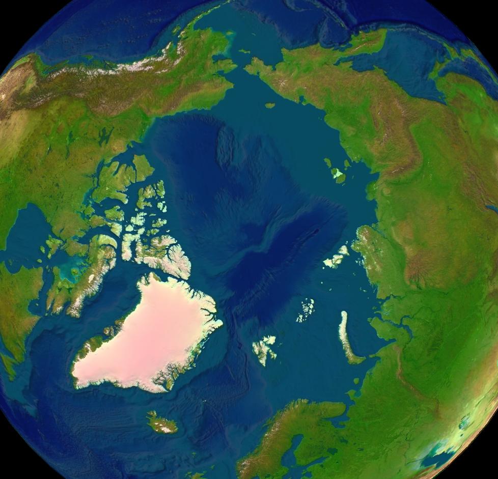
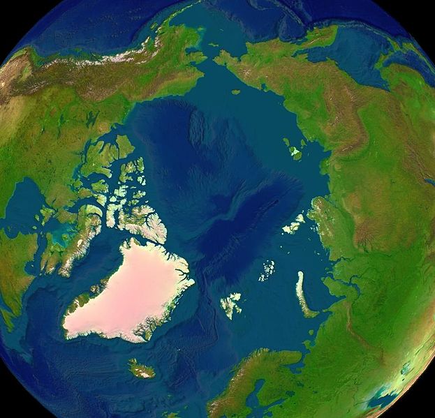
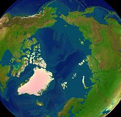
Satellite image of the Arctic surface.
| This image is in the public domain because it is a screenshot from NASA’s globe software World Wind using a public domain layer, such as Blue Marble, MODIS, Landsat, SRTM, USGS or GLOBE.
|
 |
ਫ਼ਾਈਲ ਦਾ ਅਤੀਤ
ਤਾਰੀਖ/ਸਮੇਂ ’ਤੇ ਕਲਿੱਕ ਕਰੋ ਤਾਂ ਉਸ ਸਮੇਂ ਦੀ ਫਾਈਲ ਪੇਸ਼ ਹੋ ਜਾਵੇਗੀ।
| ਮਿਤੀ/ਸਮਾਂ | ਨਮੂਨਾ | ਨਾਪ | ਵਰਤੋਂਕਾਰ | ਟਿੱਪਣੀ | |
|---|---|---|---|---|---|
| ਮੌਜੂਦਾ | 11:43, 16 ਜੂਨ 2005 | | 978 × 941 (111 KB) | Rex | {{World Wind}} Category:Arctica |
ਫ਼ਾਈਲ ਦੀ ਵਰਤੋਂ
ਇਹ ਫਾਈਲ ਹੇਠਾਂ ਦਿੱਤੇ 2 ਸਫ਼ੇ ਵਰਤਦੇ ਹਨ:
ਫ਼ਾਈਲ ਦੀ ਵਿਆਪਕ ਵਰਤੋਂ
ਇਸ ਫ਼ਾਈਲ ਨੂੰ ਹੋਰ ਹੇਠ ਲਿਖੇ ਵਿਕੀ ਵਰਤਦੇ ਹਨ:
- ang.wikipedia.org ਉੱਤੇ ਵਰਤੋਂ
- ar.wikipedia.org ਉੱਤੇ ਵਰਤੋਂ
- ast.wikipedia.org ਉੱਤੇ ਵਰਤੋਂ
- az.wikipedia.org ਉੱਤੇ ਵਰਤੋਂ
- ba.wikipedia.org ਉੱਤੇ ਵਰਤੋਂ
- bg.wikipedia.org ਉੱਤੇ ਵਰਤੋਂ
- bh.wikipedia.org ਉੱਤੇ ਵਰਤੋਂ
- br.wikipedia.org ਉੱਤੇ ਵਰਤੋਂ
- ca.wikipedia.org ਉੱਤੇ ਵਰਤੋਂ
- ce.wikipedia.org ਉੱਤੇ ਵਰਤੋਂ
- da.wikipedia.org ਉੱਤੇ ਵਰਤੋਂ
- de.wikipedia.org ਉੱਤੇ ਵਰਤੋਂ
- de.wiktionary.org ਉੱਤੇ ਵਰਤੋਂ
- el.wikipedia.org ਉੱਤੇ ਵਰਤੋਂ
- el.wiktionary.org ਉੱਤੇ ਵਰਤੋਂ
- en.wikipedia.org ਉੱਤੇ ਵਰਤੋਂ
- Talk:Causes of climate change
- Talk:Inuit
- Talk:Inuit languages
- Talk:Newfoundland and Labrador
- Talk:Nostratic languages
- Talk:North Sea
- Arctic
- Talk:Aleuts
- Talk:Nunavut
- Talk:Svalbard
- Talk:Ellesmere Island
- Talk:Sámi languages
- Talk:Whale
- Talk:Sámi peoples
- Talk:Northern Canada
- Talk:Narwhal
- Talk:Alaska
- Talk:Arctic Circle
- Talk:Parka
- Talk:Orca
- Talk:Sápmi
- Talk:Nunavik
- Talk:Beringia
- Talk:Steller sea lion
- Talk:Greenland
- Talk:Yukon
- Talk:Svalbard and Jan Mayen
- Talk:Inuvik
- Talk:Beluga whale
- Talk:Tundra
ਇਸ ਫ਼ਾਈਲ ਦੀ ਹੋਰ ਵਿਆਪਕ ਵਰਤੋਂ ਵੇਖੋ।