ਤਸਵੀਰ:COMITATUS HOLLANDIAE 1682.jpg

ਇਸ ਝਾਤ ਦਾ ਅਕਾਰ: 722 × 599 ਪਿਕਸਲ. ਹੋਰ ਰੈਜ਼ੋਲਿਊਸ਼ਨਜ਼: 289 × 240 ਪਿਕਸਲ | 578 × 480 ਪਿਕਸਲ | 925 × 768 ਪਿਕਸਲ | 1,233 × 1,024 ਪਿਕਸਲ | 2,467 × 2,048 ਪਿਕਸਲ | 4,400 × 3,653 ਪਿਕਸਲ.
ਅਸਲ ਫ਼ਾਈਲ (4,400 × 3,653 ਪਿਕਸਲ, ਫ਼ਾਈਲ ਅਕਾਰ: 4.19 MB, MIME ਕਿਸਮ: image/jpeg)
ਸਾਰ
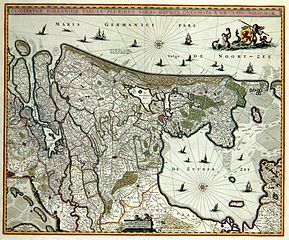
| ਵੇਰਵਾ | COMITATUS HOLLANDIAE TABULA PLURIBUS LOCIS RECENS EMENDATA A NICOLAO VISSCHER (historic map of Holland) |
| ਮਿਤੀ | |
| ਸਰੋਤ | www.geheugenvannederland.nl |
| ਲਿਖਾਰੀ | Nicolaas Visscher |
ਲਸੰਸ
|
This work is in the public domain in its country of origin and other countries and areas where the copyright term is the author's life plus 100 years or fewer. | |
| This file has been identified as being free of known restrictions under copyright law, including all related and neighboring rights. | |
ਫ਼ਾਈਲ ਦਾ ਅਤੀਤ
ਤਾਰੀਖ/ਸਮੇਂ ’ਤੇ ਕਲਿੱਕ ਕਰੋ ਤਾਂ ਉਸ ਸਮੇਂ ਦੀ ਫਾਈਲ ਪੇਸ਼ ਹੋ ਜਾਵੇਗੀ।
| ਮਿਤੀ/ਸਮਾਂ | ਨਮੂਨਾ | ਨਾਪ | ਵਰਤੋਂਕਾਰ | ਟਿੱਪਣੀ | |
|---|---|---|---|---|---|
| ਮੌਜੂਦਾ | 15:46, 4 ਜਨਵਰੀ 2008 | | 4,400 × 3,653 (4.19 MB) | P199 | {{Information |Description=''COMITATUS HOLLANDIAE TABULA PLURIBUS LOCIS RECENS EMENDATA A NICOLAO VISSCHER'' (historic map of Holland) |Source=www.geheugenvannederland.nl |Date=1682 |Author=Nicolaas Visscher |Permission= |other_versions= }} [[Category:Ol |
ਫ਼ਾਈਲ ਦੀ ਵਰਤੋਂ
ਇਹ ਫਾਈਲ ਹੇਠਾਂ ਦਿੱਤਾ ਸਫ਼ਾ ਵਰਤਦਾ ਹੈ:
ਫ਼ਾਈਲ ਦੀ ਵਿਆਪਕ ਵਰਤੋਂ
ਇਸ ਫ਼ਾਈਲ ਨੂੰ ਹੋਰ ਹੇਠ ਲਿਖੇ ਵਿਕੀ ਵਰਤਦੇ ਹਨ:
- ar.wikipedia.org ਉੱਤੇ ਵਰਤੋਂ
- ast.wikipedia.org ਉੱਤੇ ਵਰਤੋਂ
- cs.wikipedia.org ਉੱਤੇ ਵਰਤੋਂ
- da.wikipedia.org ਉੱਤੇ ਵਰਤੋਂ
- en.wikipedia.org ਉੱਤੇ ਵਰਤੋਂ
- es.wikipedia.org ਉੱਤੇ ਵਰਤੋਂ
- hy.wikipedia.org ਉੱਤੇ ਵਰਤੋਂ
- it.wikipedia.org ਉੱਤੇ ਵਰਤੋਂ
- kn.wikipedia.org ਉੱਤੇ ਵਰਤੋਂ
- ro.wikipedia.org ਉੱਤੇ ਵਰਤੋਂ
- sl.wikipedia.org ਉੱਤੇ ਵਰਤੋਂ
- ta.wikipedia.org ਉੱਤੇ ਵਰਤੋਂ
- zh.wikipedia.org ਉੱਤੇ ਵਰਤੋਂ