ਤਸਵੀਰ:California county map (Inland Empire highlighted).svg

Size of this PNG preview of this SVG file: 487 × 599 ਪਿਕਸਲ. ਹੋਰ ਰੈਜ਼ੋਲਿਊਸ਼ਨਜ਼: 195 × 240 ਪਿਕਸਲ | 390 × 480 ਪਿਕਸਲ | 624 × 768 ਪਿਕਸਲ | 832 × 1,024 ਪਿਕਸਲ | 1,664 × 2,048 ਪਿਕਸਲ | 650 × 800 ਪਿਕਸਲ.
ਅਸਲ ਫ਼ਾਈਲ (SVG ਫ਼ਾਈਲ, ਆਮ ਤੌਰ ’ਤੇ 650 × 800 ਪਿਕਸਲ, ਫ਼ਾਈਲ ਦਾ ਅਕਾਰ: 258 KB)
.svg)
ਸਾਰ
| ਵੇਰਵਾ |
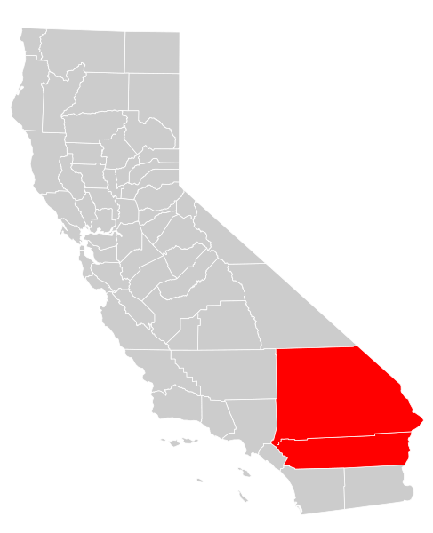
English: A map of the Inland Empire (California) metropolitan area of California, which consists of the counties of Riverside and San Bernadino |
| ਮਿਤੀ | |
| ਸਰੋਤ | Own work based on: California county map (Riverside County highlighted).svg |
| ਲਿਖਾਰੀ | Optigan13 |
| SVG genesis | and with Inkscape. This Adobe SVG locator map is very large because Optigan13 kept the superfluous Adobe PGF or other CDATA garbage . |
.svg)
ਲਸੰਸ
| I, the copyright holder of this work, release this work into the public domain. This applies worldwide. In some countries this may not be legally possible; if so: I grant anyone the right to use this work for any purpose, without any conditions, unless such conditions are required by law. |
ਫ਼ਾਈਲ ਦਾ ਅਤੀਤ
ਤਾਰੀਖ/ਸਮੇਂ ’ਤੇ ਕਲਿੱਕ ਕਰੋ ਤਾਂ ਉਸ ਸਮੇਂ ਦੀ ਫਾਈਲ ਪੇਸ਼ ਹੋ ਜਾਵੇਗੀ।
| ਮਿਤੀ/ਸਮਾਂ | ਨਮੂਨਾ | ਨਾਪ | ਵਰਤੋਂਕਾਰ | ਟਿੱਪਣੀ | |
|---|---|---|---|---|---|
| ਮੌਜੂਦਾ | 23:24, 7 ਅਗਸਤ 2009 | | 650 × 800 (258 KB) | Optigan13 | {{Information |Description={{en|A map of the w:Inland Empire (California) metropolitan area of California, which consists of the counties of Riverside and San Bernadino}} |Source=Own work based on [[:File:California county map (Riverside County highli |
ਫ਼ਾਈਲ ਦੀ ਵਰਤੋਂ
ਇਸ ਫ਼ਾਈਲ ਦੀ ਵਰਤੋਂ ਕਰਨ ਵਾਲੇ ਕੋਈ ਪੰਨੇ ਨਹੀਂ ਹਨ।
ਫ਼ਾਈਲ ਦੀ ਵਿਆਪਕ ਵਰਤੋਂ
ਇਸ ਫ਼ਾਈਲ ਨੂੰ ਹੋਰ ਹੇਠ ਲਿਖੇ ਵਿਕੀ ਵਰਤਦੇ ਹਨ:
- ar.wikipedia.org ਉੱਤੇ ਵਰਤੋਂ
- en.wikipedia.org ਉੱਤੇ ਵਰਤੋਂ
- es.wikipedia.org ਉੱਤੇ ਵਰਤੋਂ
- fi.wikipedia.org ਉੱਤੇ ਵਰਤੋਂ
- ja.wikipedia.org ਉੱਤੇ ਵਰਤੋਂ
- jv.wikipedia.org ਉੱਤੇ ਵਰਤੋਂ
- ms.wikipedia.org ਉੱਤੇ ਵਰਤੋਂ
- simple.wikipedia.org ਉੱਤੇ ਵਰਤੋਂ
- tum.wikipedia.org ਉੱਤੇ ਵਰਤੋਂ
- vi.wikipedia.org ਉੱਤੇ ਵਰਤੋਂ
- www.wikidata.org ਉੱਤੇ ਵਰਤੋਂ
.svg)