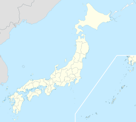
ਤਸਵੀਰ:Japan location map with side map of the Ryukyu Islands.svg

ਅਸਲ ਫ਼ਾਈਲ (SVG ਫ਼ਾਈਲ, ਆਮ ਤੌਰ ’ਤੇ 413 × 373 ਪਿਕਸਲ, ਫ਼ਾਈਲ ਦਾ ਅਕਾਰ: 980 KB)
ਸਾਰ
| ਵੇਰਵਾ |
Deutsch: Postionskarte von Japan
Quadratische Plattkarte. Bei Nutzung der Hauptkarte mit den Hauptinseln gelten folgende geographische Begrenzungen für die (Gesamt-)Karte:
Bei Nutzung der Nebenkarte mit den Ryūkyū-Inseln gelten folgende geographische Begrenzungen für die (Gesamt-)Karte:
English: Location map of Japan
Equirectangular projection. Geographic limits to locate objects in the main map with the main islands:
Geographic limits to locate objects in the side map with the Ryukyu Islands:
日本語: 日本国の地図。
正距円筒図法。 南西諸島以外の日本を描いたメインの地図が示す領域:
南西諸島を描いた右下の地図が示す領域:
|
||
| ਮਿਤੀ | |||
| ਸਰੋਤ | ਆਪਣਾ ਕੰਮ | ||
| ਲਿਖਾਰੀ | Maximilian Dörrbecker (Chumwa) | ||
| ਇਜਾਜ਼ਤ (ਇਸ ਫ਼ਾਈਲ ਦੀ ਮੁੜਵਰਤੋਂ ਕਰੋ) |
I, the copyright holder of this work, hereby publish it under the following licenses:
ਇਸ ਫ਼ਾਈਲ ਦਾ ਲਸੰਸ ਕ੍ਰਿਏਟਿਵ ਕਾਮਨਜ਼ ਐਟ੍ਰੀਬਿਊਸ਼ਨ-ਸ਼ੇਅਰ ਅਲਾਈਕ 3.0 ਅਨਪੋਰਟੇਡ ਹੈ।
ਤੁਸੀਂ ਆਪਣੀ ਮਰਜ਼ੀ ਦਾ ਲਸੰਸ ਚੁਣ ਸਕਦੇ ਹੋ। |
||
| Other versions |
Derivative works of this file: |
||
| SVG genesis | This map was created with Adobe Illustrator.
|


ਫ਼ਾਈਲ ਦਾ ਅਤੀਤ
ਤਾਰੀਖ/ਸਮੇਂ ’ਤੇ ਕਲਿੱਕ ਕਰੋ ਤਾਂ ਉਸ ਸਮੇਂ ਦੀ ਫਾਈਲ ਪੇਸ਼ ਹੋ ਜਾਵੇਗੀ।
| ਮਿਤੀ/ਸਮਾਂ | ਨਮੂਨਾ | ਨਾਪ | ਵਰਤੋਂਕਾਰ | ਟਿੱਪਣੀ | |
|---|---|---|---|---|---|
| ਮੌਜੂਦਾ | 14:21, 3 ਅਪਰੈਲ 2022 | | 413 × 373 (980 KB) | Peka | Reverted to version as of 10:18, 10 August 2021; no discuss about this change |
| 10:18, 10 ਅਗਸਤ 2021 |  | 413 × 373 (1.56 MB) | 호로조 | Liancourts Rock isn't territory of Japan | |
| 05:19, 14 ਨਵੰਬਰ 2020 |  | 413 × 373 (980 KB) | AichiWikiFixer | Fix borders. | |
| 13:53, 30 ਅਕਤੂਬਰ 2010 |  | 413 × 373 (926 KB) | NordNordWest | Liancourts Rock boundary | |
| 01:15, 17 ਸਤੰਬਰ 2010 |  | 413 × 373 (1.56 MB) | Dinamik | medium color for disputed territories | |
| 11:41, 21 ਮਾਰਚ 2010 |  | 413 × 373 (1.52 MB) | Chumwa | Präfekturgrenzen bereinigt | |
| 13:33, 20 ਮਾਰਚ 2010 |  | 413 × 373 (1.71 MB) | Chumwa | Trennlinie zu Nebenkarte etwas verbreitert | |
| 09:50, 20 ਮਾਰਚ 2010 |  | 413 × 373 (1.92 MB) | Chumwa | == {{int:filedesc}} == {{Information |Description= {{de|Postionskarte von Japan}} Quadratische Plattkarte. Bei Nutzung der Hauptkarte mit den Hauptinseln gelten folgende geographische Begrenzungen für die (Gesamt-)Karte: * N: 45°51'37" N |
ਫ਼ਾਈਲ ਦੀ ਵਰਤੋਂ
ਇਹ ਫਾਈਲ ਹੇਠਾਂ ਦਿੱਤੇ 6 ਸਫ਼ੇ ਵਰਤਦੇ ਹਨ:
ਫ਼ਾਈਲ ਦੀ ਵਿਆਪਕ ਵਰਤੋਂ
ਇਸ ਫ਼ਾਈਲ ਨੂੰ ਹੋਰ ਹੇਠ ਲਿਖੇ ਵਿਕੀ ਵਰਤਦੇ ਹਨ:
- ace.wikipedia.org ਉੱਤੇ ਵਰਤੋਂ
- af.wikipedia.org ਉੱਤੇ ਵਰਤੋਂ
- Osaka
- Hirosjima
- Tokio
- Nara, Nara
- Kioto
- Nagasaki
- Jokohama
- Nagoja
- Sapporo
- Kobe
- Nagano
- FIFA Sokker-Konfederasiebeker in 2001
- Nanao
- Rugbywêreldbeker 2019
- Fukuoka
- Kawasaki
- Saitama
- Sendai
- Kitakyushu
- Chiba
- Tokio-Haneda Internasionale Lughawe
- Narita Internasionale Lughawe
- Kansai Internasionale Lughawe
- Toyota, Aichi
- Groep van Sewe
- Saga (stad)
- als.wikipedia.org ਉੱਤੇ ਵਰਤੋਂ
- an.wikipedia.org ਉੱਤੇ ਵਰਤੋਂ
- ar.wikipedia.org ਉੱਤੇ ਵਰਤੋਂ
ਇਸ ਫ਼ਾਈਲ ਦੀ ਹੋਰ ਵਿਆਪਕ ਵਰਤੋਂ ਵੇਖੋ।