ਤਸਵੀਰ:Map of Maryland highlighting Baltimore City.svg

Size of this PNG preview of this SVG file: 800 × 419 ਪਿਕਸਲ. ਹੋਰ ਰੈਜ਼ੋਲਿਊਸ਼ਨਜ਼: 320 × 167 ਪਿਕਸਲ | 640 × 335 ਪਿਕਸਲ | 1,024 × 536 ਪਿਕਸਲ | 1,280 × 670 ਪਿਕਸਲ | 2,560 × 1,340 ਪਿਕਸਲ | 3,858 × 2,019 ਪਿਕਸਲ.
ਅਸਲ ਫ਼ਾਈਲ (SVG ਫ਼ਾਈਲ, ਆਮ ਤੌਰ ’ਤੇ 3,858 × 2,019 ਪਿਕਸਲ, ਫ਼ਾਈਲ ਦਾ ਅਕਾਰ: 139 KB)
ਸਾਰ
| ਵੇਰਵਾ |
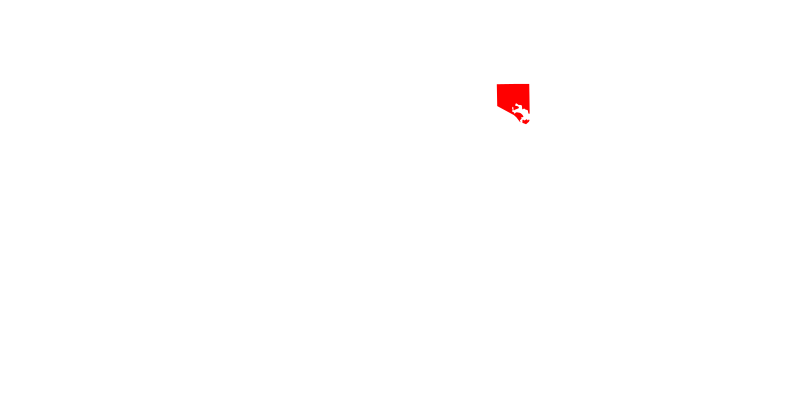
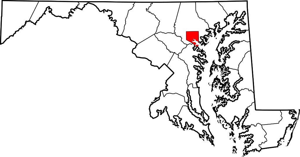
English: This is a locator map showing Baltimore in Maryland. For more information, see Commons:United States county locator maps. |
| ਮਿਤੀ | |
| ਸਰੋਤ |
ਆਪਣਾ ਕੰਮ: English: The maps use data from nationalatlas.gov, specifically countyp020.tar.gz on the Raw Data Download page. The maps also use state outline data from statesp020.tar.gz. The Florida maps use hydrogm020.tar.gz to display Lake Okeechobee. |
| ਲਿਖਾਰੀ | David Benbennick |
ਲਸੰਸ
| I, the copyright holder of this work, release this work into the public domain. This applies worldwide. In some countries this may not be legally possible; if so: I grant anyone the right to use this work for any purpose, without any conditions, unless such conditions are required by law. |
ਫ਼ਾਈਲ ਦਾ ਅਤੀਤ
ਤਾਰੀਖ/ਸਮੇਂ ’ਤੇ ਕਲਿੱਕ ਕਰੋ ਤਾਂ ਉਸ ਸਮੇਂ ਦੀ ਫਾਈਲ ਪੇਸ਼ ਹੋ ਜਾਵੇਗੀ।
| ਮਿਤੀ/ਸਮਾਂ | ਨਮੂਨਾ | ਨਾਪ | ਵਰਤੋਂਕਾਰ | ਟਿੱਪਣੀ | |
|---|---|---|---|---|---|
| ਮੌਜੂਦਾ | 17:56, 6 ਮਾਰਚ 2010 | | 3,858 × 2,019 (139 KB) | Tom | Reverted to version as of 12:48, 12 February 2006 - inconsistent with other counties in state |
| 01:03, 10 ਅਗਸਤ 2008 |  | 3,858 × 2,019 (226 KB) | AMK1211 | {{Information |Description= |Source= |Date= |Author= |Permission= |other_versions= }} | |
| 12:48, 12 ਫ਼ਰਵਰੀ 2006 |  | 3,858 × 2,019 (139 KB) | David Benbennick | {{subst:User:Dbenbenn/clm|county=Baltimore City|state=Maryland|type=city}} |
ਫ਼ਾਈਲ ਦੀ ਵਰਤੋਂ
ਇਹ ਫਾਈਲ ਹੇਠਾਂ ਦਿੱਤਾ ਸਫ਼ਾ ਵਰਤਦਾ ਹੈ:
ਫ਼ਾਈਲ ਦੀ ਵਿਆਪਕ ਵਰਤੋਂ
ਇਸ ਫ਼ਾਈਲ ਨੂੰ ਹੋਰ ਹੇਠ ਲਿਖੇ ਵਿਕੀ ਵਰਤਦੇ ਹਨ:
- ang.wikipedia.org ਉੱਤੇ ਵਰਤੋਂ
- ar.wikipedia.org ਉੱਤੇ ਵਰਤੋਂ
- arz.wikipedia.org ਉੱਤੇ ਵਰਤੋਂ
- ast.wikipedia.org ਉੱਤੇ ਵਰਤੋਂ
- bn.wikipedia.org ਉੱਤੇ ਵਰਤੋਂ
- br.wikipedia.org ਉੱਤੇ ਵਰਤੋਂ
- ca.wikipedia.org ਉੱਤੇ ਵਰਤੋਂ
- cy.wikipedia.org ਉੱਤੇ ਵਰਤੋਂ
- de.wikipedia.org ਉੱਤੇ ਵਰਤੋਂ
- diq.wikipedia.org ਉੱਤੇ ਵਰਤੋਂ
- el.wikipedia.org ਉੱਤੇ ਵਰਤੋਂ
- en.wikipedia.org ਉੱਤੇ ਵਰਤੋਂ
- eo.wikipedia.org ਉੱਤੇ ਵਰਤੋਂ
- es.wikipedia.org ਉੱਤੇ ਵਰਤੋਂ
- et.wikipedia.org ਉੱਤੇ ਵਰਤੋਂ
- eu.wikipedia.org ਉੱਤੇ ਵਰਤੋਂ
- fa.wikipedia.org ਉੱਤੇ ਵਰਤੋਂ
- fi.wikipedia.org ਉੱਤੇ ਵਰਤੋਂ
- fo.wikipedia.org ਉੱਤੇ ਵਰਤੋਂ
- fr.wikipedia.org ਉੱਤੇ ਵਰਤੋਂ
- ga.wikipedia.org ਉੱਤੇ ਵਰਤੋਂ
- gl.wikipedia.org ਉੱਤੇ ਵਰਤੋਂ
- he.wikipedia.org ਉੱਤੇ ਵਰਤੋਂ
- hu.wikipedia.org ਉੱਤੇ ਵਰਤੋਂ
- hy.wikipedia.org ਉੱਤੇ ਵਰਤੋਂ
- id.wikipedia.org ਉੱਤੇ ਵਰਤੋਂ
- ilo.wikipedia.org ਉੱਤੇ ਵਰਤੋਂ
- incubator.wikimedia.org ਉੱਤੇ ਵਰਤੋਂ
- io.wikipedia.org ਉੱਤੇ ਵਰਤੋਂ
- it.wikipedia.org ਉੱਤੇ ਵਰਤੋਂ
- ja.wikipedia.org ਉੱਤੇ ਵਰਤੋਂ
- kab.wikipedia.org ਉੱਤੇ ਵਰਤੋਂ
- kn.wikipedia.org ਉੱਤੇ ਵਰਤੋਂ
- ko.wikipedia.org ਉੱਤੇ ਵਰਤੋਂ
ਇਸ ਫ਼ਾਈਲ ਦੀ ਹੋਰ ਵਿਆਪਕ ਵਰਤੋਂ ਵੇਖੋ।