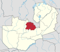
ਜ਼ਾਂਬੀਆ ਦੇ ਰਾਜ
ਜ਼ਾਂਬੀਆ ਦੀ 10 ਰਾਜਾਂ ਵਿੱਚ ਤਕਸੀਮ ਕੀਤੀ ਗਈ ਹੈ।

| ਰਾਜ[1] | ਰਾਜਧਾਨੀ | ਖੇਤਰਫਲ (km²) | ਜਨਸੰਖਿਆ | ਵੱਸੋਂ ਘਣਤਾ (people/km²) |
ਜ਼ਿਲ੍ਹੇ | ਨਕਸ਼ਾ |
|---|---|---|---|---|---|---|
| ਕੇਂਦਰੀ[2] | ਕਾਬਵੇ | 94,394 | 1,307,111 | 13.4 | 11 | 
|
| ਕਾਪਰਬੈਲਟ[3] | ਨਡੋਲਾ | 31,328 | 1,972,317 | 62.5 | 10 | 
|
| ਪੂਰਬੀ | ਚਿਪਾਤਾ | 51,476 | 1,592,661 | 24.7 | 9 | 
|
| ਲੂਆਪੂਲਾ | ਮਾਨਸਾ | 50,567 | 991,927 | 19.0 | 11 | 
|
| ਲੁਸਾਕਾ[2] | ਲੁਸਾਕਾ | 21,896 | 2,191,225 | 100.4 | 8 | 
|
| ਮੁਚਿੰਗਾ[4] | ਚਿੰਸਾਲੀ[5] | 87,806 | 711,657[6] | 8.1 | 7 | 
|
| ਉੱਤਰੀ | ਕਾਸਾਮਾ | 77,650 | 1,105,824[7] | 14.2 | 9 | 
|
| ਉੱਤਰ-ਪੱਛਮੀ | Solwezi | 125,826 | 727,044 | 5.6 | 9 | 
|
| ਦੱਖਣੀ | ਚੋਮਾ | 85,283 | 1,589,926 | 18.8 | 13 | 
|
| ਪੱਛਮੀ[3] | ਮੋਂਗੂ | 126,386 | 902,974 | 7.0 | 16 | 
|
| ਜ਼ਾਂਬੀਆ | ਲੁਸਾਕਾ | 752,612 | 13,092,666 | 17.3 | 103 |
ਹਵਾਲੇ
ਸੋਧੋ- ↑ Gwillim Law. "Zambia Provinces". Retrieved 2015-06-18. (Population figures are from the census of 2010).
- ↑ 2.0 2.1 Lusaka province was split from Central province in 1973. Initially Lusaka province was only 360 km², but by 1988 it had been enlarged to its present size.
- ↑ 3.0 3.1 The Copperbelt province was known as Western Province until 1969. At the same time the name of the Barotseland province was changed to Western province.
- ↑ Created on November 2011, consisting 5 districts from Northern Province and one from Eastern.
- ↑ "Zambia's 10th Province, Muchinga, Ministry of Local Government and Housing, Zambia". Archived from the original on 2014-01-18. Retrieved 2016-10-01.
{{cite web}}: Unknown parameter|dead-url=ignored (|url-status=suggested) (help) - ↑ http://www.citypopulation.de/php/zambia-admin.php
- ↑ population figures adjusted for new smaller area