ਤਸਵੀਰ:Ahar Cenotaphs.JPG

ਇਸ ਝਾਤ ਦਾ ਅਕਾਰ: 800 × 533 ਪਿਕਸਲ. ਹੋਰ ਰੈਜ਼ੋਲਿਊਸ਼ਨਜ਼: 320 × 213 ਪਿਕਸਲ | 640 × 427 ਪਿਕਸਲ | 1,024 × 683 ਪਿਕਸਲ | 1,280 × 853 ਪਿਕਸਲ | 2,560 × 1,707 ਪਿਕਸਲ | 4,272 × 2,848 ਪਿਕਸਲ.
ਅਸਲ ਫ਼ਾਈਲ (4,272 × 2,848 ਪਿਕਸਲ, ਫ਼ਾਈਲ ਅਕਾਰ: 5.09 MB, MIME ਕਿਸਮ: image/jpeg)
ਸਾਰ
| ਵੇਰਵਾ |
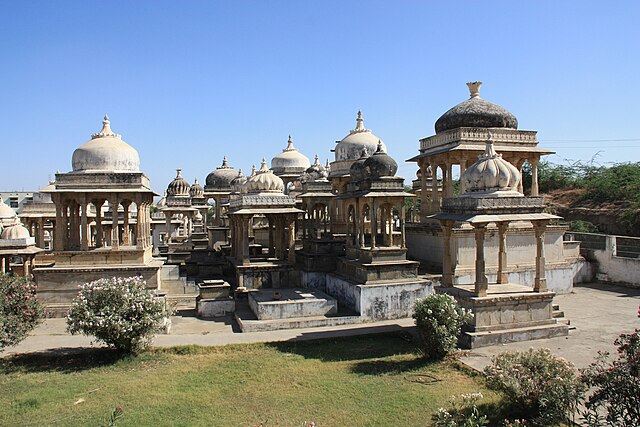
English: Photo of the royal cenotaphs in Ahar, near Udaipur, India |
| ਮਿਤੀ | |
| ਸਰੋਤ | ਆਪਣਾ ਕੰਮ |
| ਲਿਖਾਰੀ | Jstplace |
| Camera location | | View this and other nearby images on: OpenStreetMap |
|---|
ਲਸੰਸ
| I, the copyright holder of this work, release this work into the public domain. This applies worldwide. In some countries this may not be legally possible; if so: I grant anyone the right to use this work for any purpose, without any conditions, unless such conditions are required by law. |
ਫ਼ਾਈਲ ਦਾ ਅਤੀਤ
ਤਾਰੀਖ/ਸਮੇਂ ’ਤੇ ਕਲਿੱਕ ਕਰੋ ਤਾਂ ਉਸ ਸਮੇਂ ਦੀ ਫਾਈਲ ਪੇਸ਼ ਹੋ ਜਾਵੇਗੀ।
| ਮਿਤੀ/ਸਮਾਂ | ਨਮੂਨਾ | ਨਾਪ | ਵਰਤੋਂਕਾਰ | ਟਿੱਪਣੀ | |
|---|---|---|---|---|---|
| ਮੌਜੂਦਾ | 11:02, 25 ਅਪਰੈਲ 2010 | | 4,272 × 2,848 (5.09 MB) | Jstplace | {{Information |Description={{en|1=Photo of the royal cenotaphs in Ahar, near Udaipur, India}} |Source={{own}} |Author=Jstplace |Date=2010-04-10 |Permission= |other_versions= }} |
ਫ਼ਾਈਲ ਦੀ ਵਰਤੋਂ
ਇਹ ਫਾਈਲ ਹੇਠਾਂ ਦਿੱਤਾ ਸਫ਼ਾ ਵਰਤਦਾ ਹੈ:
ਫ਼ਾਈਲ ਦੀ ਵਿਆਪਕ ਵਰਤੋਂ
ਇਸ ਫ਼ਾਈਲ ਨੂੰ ਹੋਰ ਹੇਠ ਲਿਖੇ ਵਿਕੀ ਵਰਤਦੇ ਹਨ:
- de.wikipedia.org ਉੱਤੇ ਵਰਤੋਂ
- en.wikipedia.org ਉੱਤੇ ਵਰਤੋਂ
- en.wikivoyage.org ਉੱਤੇ ਵਰਤੋਂ
- es.wikipedia.org ਉੱਤੇ ਵਰਤੋਂ
- ja.wikipedia.org ਉੱਤੇ ਵਰਤੋਂ
- ru.wikipedia.org ਉੱਤੇ ਵਰਤੋਂ
- ta.wikipedia.org ਉੱਤੇ ਵਰਤੋਂ
- th.wikipedia.org ਉੱਤੇ ਵਰਤੋਂ
- uk.wikipedia.org ਉੱਤੇ ਵਰਤੋਂ
- www.wikidata.org ਉੱਤੇ ਵਰਤੋਂ