ਤਸਵੀਰ:Rhineland-Palatinate relief location map.svg

Size of this PNG preview of this SVG file: 452 × 600 ਪਿਕਸਲ. ਹੋਰ ਰੈਜ਼ੋਲਿਊਸ਼ਨਜ਼: 181 × 240 ਪਿਕਸਲ | 362 × 480 ਪਿਕਸਲ | 579 × 768 ਪਿਕਸਲ | 772 × 1,024 ਪਿਕਸਲ | 1,543 × 2,048 ਪਿਕਸਲ | 930 × 1,234 ਪਿਕਸਲ.
ਅਸਲ ਫ਼ਾਈਲ (SVG ਫ਼ਾਈਲ, ਆਮ ਤੌਰ ’ਤੇ 930 × 1,234 ਪਿਕਸਲ, ਫ਼ਾਈਲ ਦਾ ਅਕਾਰ: 3.64 MB)
ਸਾਰ
| ਵੇਰਵਾ |
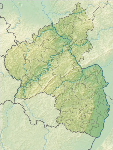
Geografische Begrenzung der Karte:
Geographic limits of the map:
|
| ਮਿਤੀ | |
| ਸਰੋਤ |
Own work using:
|
| ਲਿਖਾਰੀ | NordNordWest + Lencer |
| Other versions |
|


|
This map has been made or improved in the German Kartenwerkstatt (Map Lab). You can propose maps to improve as well.
|
ਲਸੰਸ
This file is licensed under the Creative Commons Attribution-Share Alike 3.0 Germany license.
ਐਟਰੀਬਿਊਸ਼ਨ: Karte/Map: NordNordWest/Lencer, Lizenz/Licence: Creative Commons by-sa-3.0 de
- ਤੁਹਾਨੂੰ ਖੁੱਲ੍ਹ ਹੈ:
- ਸਾਂਝਾ ਕਰਨ ਦੀ – ਰਚਨਾ ਨੂੰ ਕਾਪੀ, ਵੰਡਣਾ ਅਤੇ ਭੇਜਣਾ
- ਮੁੜ-ਰਲ਼ਾਉਣ ਦੀ – ਰਚਨਾ ਨੂੰ ਢਾਲਣਾ
- ਥੱਲੇ ਲਿਖੀਆਂ ਸ਼ਰਤਾਂ ਹੇਠ:
- ਗੁਣਾਂ ਦੀ ਦੱਸ – ਉਚਿਤ ਕ੍ਰੈਡਿਟ ਦੇਵੋ, ਲਾਇਸੰਸ ਦਾ ਇੱਕ ਲਿੰਕ ਪ੍ਰਦਾਨ ਕਰੋ ਅਤੇ ਇਹ ਦਰਸਾਓ ਕਿ ਕੀ ਤਬਦੀਲੀਆਂ ਕੀਤੀਆਂ ਗਈਆਂ ਸਨ। ਤੁਸੀਂ ਇਹ ਕਿਸੇ ਵੀ ਵਾਜਬ ਤਰੀਕੇ ਨਾਲ ਕਰ ਸਕਦੇ ਹੋ, ਪਰ ਇਹ ਤਰੀਕਾ ਅਜਿਹਾ ਨਹੀਂ ਹੋਣਾ ਚਾਹੀਦਾ ਜੋ ਇਹ ਦਰਸਾਵੇ ਕਿ ਲਾਇਸੰਸਕਰਤਾ ਤੁਹਾਨੂੰ ਜਾਂ ਤੁਹਾਡੀ ਵਰਤੋਂ ਦਾ ਸਮਰਥਨ ਕਰਦਾ ਹੈ।
- ਸ਼ੇਅਰ ਅਲਾਈਕ – ਜੇਕਰ ਤੁਸੀਂ ਸਮੱਗਰੀ ਨੂੰ ਰੀਮਿਕਸ ਕਰਦੇ ਹੋ, ਬਦਲਦੇ ਹੋ ਜਾਂ ਬਣਾਉਂਦੇ ਹੋ, ਤਾਂ ਆਪਣੇ ਯੋਗਦਾਨ ਇੱਕੋ ਜਿਹੇ ਜਾਂ ਅਨੁਕੂਲ ਲਾਇਸੰਸ ਦੇ ਅਧੀਨ ਕਰੋ।

ਫ਼ਾਈਲ ਦਾ ਅਤੀਤ
ਤਾਰੀਖ/ਸਮੇਂ ’ਤੇ ਕਲਿੱਕ ਕਰੋ ਤਾਂ ਉਸ ਸਮੇਂ ਦੀ ਫਾਈਲ ਪੇਸ਼ ਹੋ ਜਾਵੇਗੀ।
| ਮਿਤੀ/ਸਮਾਂ | ਨਮੂਨਾ | ਨਾਪ | ਵਰਤੋਂਕਾਰ | ਟਿੱਪਣੀ | |
|---|---|---|---|---|---|
| ਮੌਜੂਦਾ | 09:29, 1 ਜੁਲਾਈ 2014 | | 930 × 1,234 (3.64 MB) | NordNordWest | upd |
| 21:07, 2 ਨਵੰਬਰ 2013 |  | 930 × 1,234 (3.64 MB) | NordNordWest | == {{int:filedesc}} == {{Information |Description= {{de|Positionskarte für Rheinland-Pfalz, Deutschland}} Geografische Begrenzung der Karte: * N: 50.9796147° N * S: 48.7869615° N * W: 6.02600097° O * O: 8... |
ਫ਼ਾਈਲ ਦੀ ਵਰਤੋਂ
ਇਹ ਫਾਈਲ ਹੇਠਾਂ ਦਿੱਤੇ 3 ਸਫ਼ੇ ਵਰਤਦੇ ਹਨ:
ਫ਼ਾਈਲ ਦੀ ਵਿਆਪਕ ਵਰਤੋਂ
ਇਸ ਫ਼ਾਈਲ ਨੂੰ ਹੋਰ ਹੇਠ ਲਿਖੇ ਵਿਕੀ ਵਰਤਦੇ ਹਨ:
- ban.wikipedia.org ਉੱਤੇ ਵਰਤੋਂ
- bg.wikipedia.org ਉੱਤੇ ਵਰਤੋਂ
- Кайзерслаутерн
- Бинген ам Рейн
- Майнц
- Трир
- Лудвигсхафен
- Шпайер
- Кобленц
- Идар-Оберщайн
- Айфел
- Вормс
- Нойщат ан дер Вайнщрасе
- Бад Дюркхайм
- Ландау
- Прюм
- Прюм (река)
- Аремберг
- Зимерн
- Шаблон:ПК Германия Рейнланд-Пфалц
- Цвайбрюкен
- Пирмазенс
- Фалендар
- Теодор Хойс (мост)
- Каценелнбоген
- Гермерсхайм
- Бад Нойенар-Арвайлер
- Ингелхайм ам Рейн
- Алцай
- Опенхайм
- Оберланщайн
- Диц
- Хорнбах
- Вестербург
- Бад Кройцнах
- Пфафен-Швабенхайм
- Бад Зобернхайм
- Щаркенбург
- Хахенбург
- Алтенкирхен
- Фирнебург
- Кирххаймболанден
- Фридевалд
- Лауренбург
- Браубах
- Спонхайм
- Анхаузен
- Андернах
- Нойвид
- Майзенхайм
- Айзенберг (Рейнланд-Пфалц)
ਇਸ ਫ਼ਾਈਲ ਦੀ ਹੋਰ ਵਿਆਪਕ ਵਰਤੋਂ ਵੇਖੋ।