ਤਸਵੀਰ:Vancouver de.png
ਇਸ ਝਾਤ ਦਾ ਅਕਾਰ: 800 × 574 ਪਿਕਸਲ. ਹੋਰ ਰੈਜ਼ੋਲਿਊਸ਼ਨਜ਼: 320 × 230 ਪਿਕਸਲ | 640 × 459 ਪਿਕਸਲ | 1,024 × 735 ਪਿਕਸਲ | 1,280 × 919 ਪਿਕਸਲ | 1,666 × 1,196 ਪਿਕਸਲ.
ਅਸਲ ਫ਼ਾਈਲ (1,666 × 1,196 ਪਿਕਸਲ, ਫ਼ਾਈਲ ਅਕਾਰ: 4.02 MB, MIME ਕਿਸਮ: image/png)
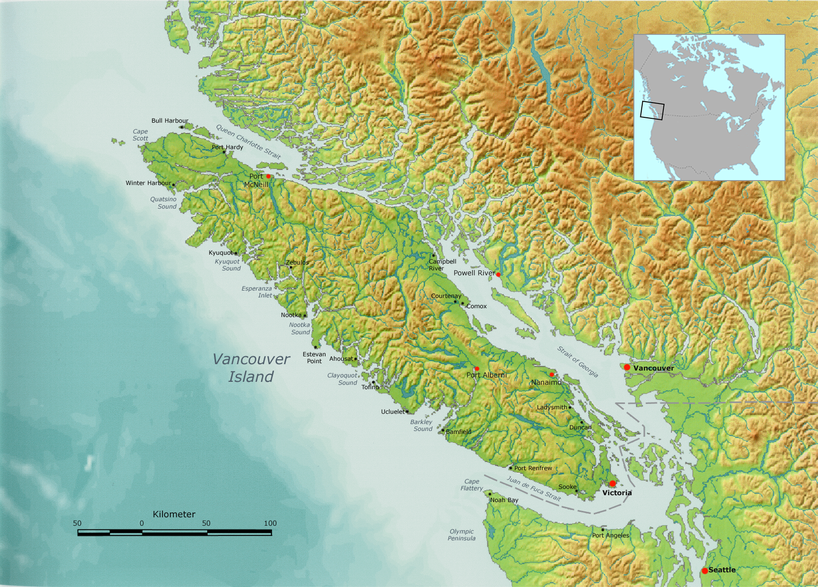
| ਵੇਰਵਾ | Vancouver Island, as well as the Canada-US border. | ||||
| ਮਿਤੀ | |||||
| ਸਰੋਤ | Own work by Nikater, submitted to the public domain. Background map courtesy of Demis, www.demis.nl. | ||||
| ਲਿਖਾਰੀ | User:Nikater | ||||
| ਇਜਾਜ਼ਤ (ਇਸ ਫ਼ਾਈਲ ਦੀ ਮੁੜਵਰਤੋਂ ਕਰੋ) |
|
||||
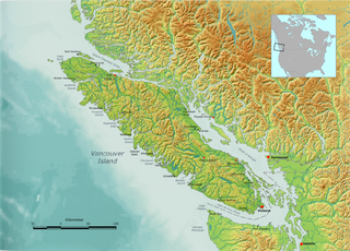
| Other versions | Derivative works of this file: Vancouver Island, with Lasqueti Island highlighted.png |
ਫ਼ਾਈਲ ਦਾ ਅਤੀਤ
ਤਾਰੀਖ/ਸਮੇਂ ’ਤੇ ਕਲਿੱਕ ਕਰੋ ਤਾਂ ਉਸ ਸਮੇਂ ਦੀ ਫਾਈਲ ਪੇਸ਼ ਹੋ ਜਾਵੇਗੀ।
| ਮਿਤੀ/ਸਮਾਂ | ਨਮੂਨਾ | ਨਾਪ | ਵਰਤੋਂਕਾਰ | ਟਿੱਪਣੀ | |
|---|---|---|---|---|---|
| ਮੌਜੂਦਾ | 09:29, 6 ਅਕਤੂਬਰ 2007 | | 1,666 × 1,196 (4.02 MB) | Nikater | {{Information |Description=Vancouver Island |Source=Own work by Nikater, submitted to the public domain. Background map courtesy of Demis, www.demis.nl. |Date=6 October 2007 |Author=User:Nikater |Permission={{PD-Demis}} }} |
ਫ਼ਾਈਲ ਦੀ ਵਰਤੋਂ
ਇਸ ਫ਼ਾਈਲ ਦੀ ਵਰਤੋਂ ਕਰਨ ਵਾਲੇ ਕੋਈ ਪੰਨੇ ਨਹੀਂ ਹਨ।
ਫ਼ਾਈਲ ਦੀ ਵਿਆਪਕ ਵਰਤੋਂ
ਇਸ ਫ਼ਾਈਲ ਨੂੰ ਹੋਰ ਹੇਠ ਲਿਖੇ ਵਿਕੀ ਵਰਤਦੇ ਹਨ:
- af.wikipedia.org ਉੱਤੇ ਵਰਤੋਂ
- ar.wikipedia.org ਉੱਤੇ ਵਰਤੋਂ
- ast.wikipedia.org ਉੱਤੇ ਵਰਤੋਂ
- bg.wikipedia.org ਉੱਤੇ ਵਰਤੋਂ
- bn.wikipedia.org ਉੱਤੇ ਵਰਤੋਂ
- br.wikipedia.org ਉੱਤੇ ਵਰਤੋਂ
- ca.wikipedia.org ਉੱਤੇ ਵਰਤੋਂ
- cs.wikipedia.org ਉੱਤੇ ਵਰਤੋਂ
- da.wikipedia.org ਉੱਤੇ ਵਰਤੋਂ
- de.wikipedia.org ਉੱਤੇ ਵਰਤੋਂ
- en.wikipedia.org ਉੱਤੇ ਵਰਤੋਂ
- eo.wikipedia.org ਉੱਤੇ ਵਰਤੋਂ
- es.wikipedia.org ਉੱਤੇ ਵਰਤੋਂ
- Isla de Vancouver
- Estrecho de Juan de Fuca
- Islas del Golfo
- Islas San Juan
- Estrecho de Haro
- Expedición Vancouver
- Islas Discovery
- Estrecho de Johnstone
- José María Narváez
- Estrecho Rosario
- Pasaje Discovery
- Bute Inlet
- Knight Inlet
- Estrecho de la Reina Carlota
- Toba Inlet
- Barkley Sound
- Canal Cordero
- Archipiélago Broughton
- Mar de los Salish
- fi.wikipedia.org ਉੱਤੇ ਵਰਤੋਂ
- fy.wikipedia.org ਉੱਤੇ ਵਰਤੋਂ
- gl.wikipedia.org ਉੱਤੇ ਵਰਤੋਂ
- hr.wikipedia.org ਉੱਤੇ ਵਰਤੋਂ
- hu.wikipedia.org ਉੱਤੇ ਵਰਤੋਂ
ਇਸ ਫ਼ਾਈਲ ਦੀ ਹੋਰ ਵਿਆਪਕ ਵਰਤੋਂ ਵੇਖੋ।